New report shows the value of the Sargassum Information Hub
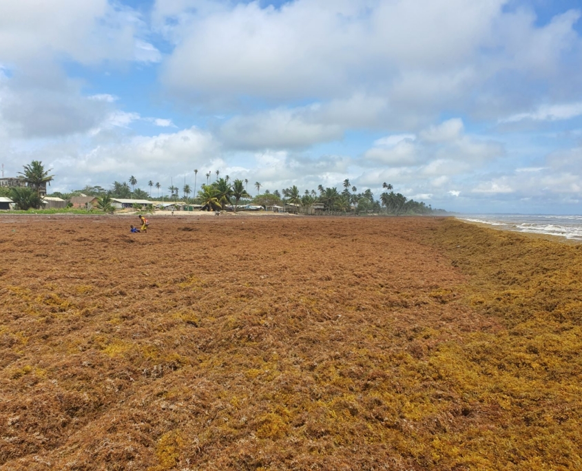
A new report shows how, through the Sargassum Information Hub, GEO Blue Planet is helping turn satellite observations into practical information for authorities responding to Sargassum influxes in Martinique for instance.
Published by the SeBS360 (From Sentinel Benefits Study to Observatory) project, the report shows how Copernicus Sentinel data can be used for forecasts and operational decisions that benefit coastal communities. It also examines the Sargassum Information Hub’s role in connecting users with Sargassum data, forecasts, research, and operational resources.
Connecting data with decisions
Sargassum monitoring draws on a wide range of sources. Copernicus Sentinel-3 data support near-real-time mapping across the Atlantic, while ocean-current models, wind data, sea-surface temperature, nutrient indicators, drones, and field observations contribute to forecasts.
Organisations including Météo-France, Mercator Ocean International, CLS, and the US National Oceanic and Atmospheric Administration (NOAA) provide forecasts over different time periods. These services help users understand where Sargassum is located, how it may move, and which coastlines may be affected.
The challenge is how to make that data useful for different organisations, governance structures, and communities. The Sargassum Information Hub helps address this by bringing monitoring products, forecast bulletins, early-warning systems, regional visualisation tools, case studies, and operational resources together in one place.
Putting information to work in Martinique
The report uses the Caribbean island of Martinique to show monitoring and forecasting tools can support on-the-ground decision-making. In Martinique, the Groupement d’Intérêt Public Sargasses (GIP Sargasses) Martinique coordinates prevention, monitoring, and management across the island. It works with public authorities, technical agencies, and local stakeholders, with support from ADEME (the French Agency for Ecological Transition).
Forecast information helps authorities decide when and where to deploy staff, equipment, and funding. It can inform the timing of clean-up operations, identify areas that may need attention, and support decisions on the placement of offshore barriers.
“The Sargassum service helps us understand where we should focus our scarce island resources to clean up sensitive coastal areas and beaches,” said Frederick Voyer of GIP Sargasses Martinique in the report. “As a result, we can reduce the impact on citizens and tourists alike as well as protecting the sensitive coastal environment.”
Reducing costs and impacts
Better forecasting can help authorities avoid unnecessary deployment and concentrate resources where they are most likely to be needed. This is particularly important when response measures are expensive.
Earlier and more targeted clean-up can also reduce health risks from gases released as Sargassum decomposes. It may limit disruption to tourism, fisheries, and coastal businesses, and reduce corrosion damage to equipment such as refrigeration and air-conditioning systems.
Overall costs can be substantial. The report refers to a 2015 survey by the Guadeloupe Chamber of Commerce, which estimated losses of US$5.7 million over six months, with one-third of coastal businesses affected. Based on a conservative estimate, it suggests that improved forecasting could help avoid losses of between US$5 million and US$20 million across the Caribbean region every year.
As well as helping to tackle influxes when they reach coastlines, forecasting may also make it possible to intercept Sargassum before it deteriorates, increasing opportunities for reuse in agriculture, energy production, or materials.
The report also highlights how the Sargassum Information Hub can help monitor international conventions such as the United Nations Convention on the Law of the Sea, the Convention on Biological Diversity, and the Sustainable Development Goals that overlap with Sargassum management, and support research into reducing and processing Sargassum.
Read the full report “Sargassum: A growing challenge being addressed through the GEO”