Publication alert!
Monitoring pelagic Sargassum inundation potential for coastal communities
ABSTRACT
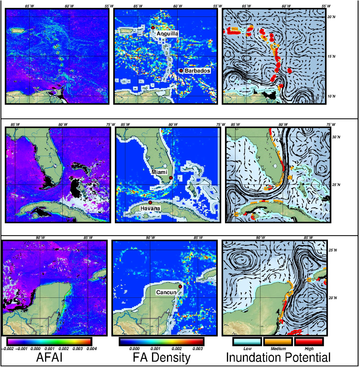
Pelagic Sargassum is a buoyant macroalgae that forms rafts at the ocean surface and serves as a biologically rich habitat for hundreds of diverse marine species. Since 2011, massive blooms of Sargassum have occurred in the tropical Atlantic and swept through the western tropical Atlantic, Caribbean Sea, and Gulf of Mexico. These recurring annual events have caused significant disruptions to coastal communities throughout the region, negatively impacting human health, tourism, fishing, navigation, and nearshore ecosystems. We present here the Sargassum Inundation Report (SIR), a product that uses satellite-based methodology to estimate and predict the future coastal inundation of pelagic Sargassum. Results from one year of SIRs show strong spatiotemporal differences in the potential of coastal inundation across the Intra-American Seas, and provide a comprehensive method for assessing its geographic distribution and temporal variation. Comparisons of SIRs to opportunistically collected photographs indicate a qualitative concordance between satellite and in situ observations. This work highlights the value of satellite observations, basin-wide and seasonal monitoring, and emphasises the need for sub-regional and weekly forecasting. SIRs show considerable promise as a tool that can eventually incorporate improved spatiotemporal resolution Sargassum imagery, ocean circulation, wind, and wave conditions to forecast the movement of Sargassum into coastal areas.

